La interfaz
Introducción
Invoking the command-line interface will make the following dialog appear.
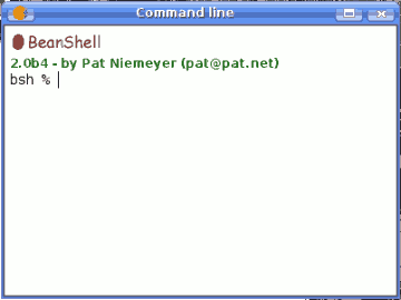
SEXTANTE command-line
The SEXTANTE command-line interface is based on BeanShell. BeanShell is a Java source interpreter with object scripting language features, that meaning that it dynamically executes standard Java syntax and extends it with common scripting conveniences such as loose types, commands, and method closures like those in Perl and JavaScript.
A detailed description of BeanShell and its usage can be found at the BeanShell website. Refer to it if you want to learn more about generic BeanShell features. This chapter covers only those particular elements which are related to SEXTANTE geoalgorithms.
By using the extension mechanisms of BeanShell, SEXTANTE adds several new commands to it, so you can run geoalgorithms or get information about the geospatial data you are using, among other things.
Java users can create small scripts and programs combining standard elements of Java with SEXTANTE commands. However, those who are not familiar with Java can also use the command-line interface to execute single processes or small sets of them, simply calling the corresponding methods.
A detailed description of all SEXTANTE commands is given next.
Obtener información sobre los datos
Algorithms need data to run. Layers and tables are identified using the name they have in the table of contents of the GIS (and which usually can be modied using GIS tool). To call a geoalgorithm you have to pass it an identifier which represents the data to use for an input.
The data() command prints a list of all data objects available to be used, along with the particular name of each one (i.e. the one you have to use to refer to it). Calling it you will get something like this:
RASTER LAYERS
-----------------
mdt25.asc

VECTOR LAYERS
-----------------
Curvas de nivel

TABLES
-----------------
Be aware that gvSIG allows you to have several layers with the same name. SEXTANTE will just take the first one which matches the specified identifier, so you should make sure you rename your data object so each one of them has a unique name.
To get more information about a particular data object, use the describe(name of data object) command. Here are a few examples of the result you will get when using it to get more information about a vector layer, a raster layer and a table.
>describe points
Type: Vector layer - Point
Number of entities: 300
Table fields: | ID | X | Y | SAND | SILT | CLAY | SOILTYPE | EXTRAPOLAT |

>describe dem25
Type: Raster layer
X min: 262846.525725
X max: 277871.525725
Y min: 4454025.0
Y max: 4464275.0
Cellsize X: 25.0
Cellsize Y: 0.0
Rows: 410
Cols: 601

>describe spatialCorrelation
Type: TableNumber of records: 156
Table fields: | Distance | I_Moran | c_Geary | Semivariance |
